Extracts taken from ‘Village Design Statement for ROTHBURY’
“Rothbury is a pleasant little town to wander through, and still shows signs of its prosperity as a late Victorian resort, brought about by the arrival of the railway (now gone) and the influence of Lord Armstrong and Cragside” – Nicholas Pevsner 1957
“To my mind, Rothbury remains a jewel in the Northumberland hills. Its situation is superb, its buildings a fascinating mix of traditional Northumbrian and post railway Victoriana. But most of all it is unspoiled. The wonderful greens and the trees are beautifully intact and lined with unbroken rows of intensely satisfying buildings. Long may it remain so.” – John Grundy 2001
A brief history
There is evidence of human habitation of Rothbury from Neolithic times. Post Conquest references link the village to the Dukes of Northumberland and the Diocese of Carlisle.
The weekly Mart was established by a charter awarded by Edward I in 1291.
Economically the village sat astride an ancient packhorse trail from Hexham to Alnmouth and a droving route down the Coquet valley. The readily available spring water encouraged the development of several breweries and public houses serving a wide rural catchment area. However, the construction of Cragside by Lord Armstrong and the opening of the railway in 1870 (connecting Rothbury with Morpeth and Newcastle) saw the rapid development of housing and services (further info., about the old railway can be sourced HERE and plans of the old Rothbury Station buildings can be viewed HERE).

The ensuing prosperous Victorian and Edwardian market town served a wide hinterland. The broad ‘High Street’, commercial buildings in ‘Bridge Street’, the early garage buildings at ‘Town Foot’ and the rebuilt ‘All Saints Church’ exemplify this businesslike but attractive Coquetdale village.
In the twentieth century the motor car brought Rothbury within easier reach of industrial Tyneside and visitors continued to come in increasing numbers to walk in the surrounding hills and enjoy the pleasures offered by a peaceful rural market town at the gateway to the National Park. This tourist industry ensures that Rothbury can continue to support an unusually good range of services. Some of the visitors elected to settle in Rothbury, either commuting to work or in retirement, resulting in further expansion of housing in the village.

Old Village Centre – showing 3-half moons public house and Parish Church
Rothbury lies astride Northumberland’s longest river – the Coquet, and nestles within a valley which varies in width from over a mile to a few hundred yards. The topography owes much to the effects of glaciation with related deposits forming the terraces on the North side of the river. The quality of the natural setting is recognised in its designation as an Area of High Landscape Value.
The wide river plain in the West narrows gradually and forms the dramatic gorge at Thrum Mill. Rocky crags on the North aspect made up of gray sandstone have provided local building material for centuries whereas the Southern banks of the Coquet are largely alluvial deposit material.
The elevation of the village varies from 310ft – 250 ft and accounts for seasonal frosts and occasional snowfalls. However the planting of over a million trees on the Cragside Estate in the 19th century is said to have raised the average temperature in the village by a full degree. Cragside and its gardens are listed in the English Heritage Register of Historic Parks and Gardens. Overall annual rainfall is slight by UK standards, but flooding of the immediate river-basin is reasonably regular due to the wide catchment area of the River Coquet in Coquetdale.

Bus negotiating the ‘Burn Foot’ in flood – watched by villagers
The prevailing winds are westerly and have an almost uninterrupted path from rural Scotland and the Atlantic. Consequently, air quality in the neighbourhood is very good and enhances the welcoming appeal of the village to visitors.
The shape of the village has been largely determined by the development of structures parallel to the East West flow of the River Coquet.
The village is made green by the effect of the grassy banked; tree lined High Street (mostly protected by Tree Preservation Orders) which culminates in the area around the Armstrong Cross and nearby All Saints Church. The Simonside and Cragside hills form the backcloth to the village. They are part of the ragged Fell Sandstone escarpment which is a central feature of the topography of Northumberland. The overall dominance of the Simonside and Cragside hills, part of the Cheviot range, provides an imposing background in all directions.

A newly built Cragside House and hills behind, before landscaping


There is a unique pictorial and video record of one of the most devastating fires to hit Bridge Street. The fire occurred in the Jubilee Hall in 1939.
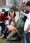 First Arbor Day Celebrated (1872)
Generally observed on the last Friday in April, Arbor Day is an unofficial US holiday designated as a day for planting trees. The holiday was founded by agriculturist Julius Sterling Morton, a Nebraska resident who believed that the prairies were in need of more trees to serve as windbreaks, hold moisture in the soil, and provide lumber for housing. To this end, he proposed that a specific day be set aside for the planting of trees.