Ahora estás siguiendo a
Error al seguir a usuario.
Este usuario no permite que los usuarios lo sigan.
Ya estás siguiendo a este usuario.
Tu plan de membresía solo permite 0 seguimientos. Mejora tu membresía aquí.
Dejaste de seguir correctamente a
Error al dejar de seguir al usuario.
Has recomendado exitosamente a
Error al recomendar al usuario.
Algo salió mal. Por favor, actualiza la página e intenta de nuevo.
Email verificado correctamente.

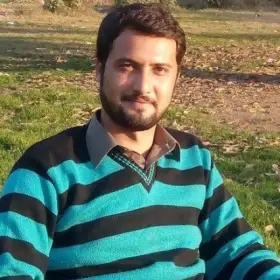
Naveed A.
@sharp759
5,0
1
0,6
0,6
100%
GIS and Remote sensing Specialist
$8 USD / hora
・

Pakistan (2:26 p. m.)
・
Se unió el octubre 18, 2016
$8 USD / hora
・
I'm a GIS and remote sensing specialist with four years of extensive experience. I have great command and control on spatial data analysis, topographic and terrain modeling, hydrological analysis, geostatistical analysis, cartography, and digital mapping, and many other works related to GIS and remote sensing. I have also command satellite image analysis and processing using remote sensing software and python.
Verificaciones
A tiempo
100 %
Dentro del presupuesto
100 %
Aceptar tarifa
100 %
Portafolio
Portafolio

Graphics designs

Graphics designs

Graphics designs

Graphics designs

Geostatistical analysis, GIS mapping and geospatial data ger

Geostatistical analysis, GIS mapping and geospatial data ger

Geostatistical analysis, GIS mapping and geospatial data ger

Topographic Analysis and Land surface Elevation Profiling

Topographic Analysis and Land surface Elevation Profiling

Topographic Analysis and Land surface Elevation Profiling

Graphics designs

Graphics designs

Graphics designs

Graphics designs

Geostatistical analysis, GIS mapping and geospatial data ger

Geostatistical analysis, GIS mapping and geospatial data ger

Geostatistical analysis, GIS mapping and geospatial data ger

Topographic Analysis and Land surface Elevation Profiling

Topographic Analysis and Land surface Elevation Profiling

Topographic Analysis and Land surface Elevation Profiling
Cambios guardados

Naveed is truly a GIS and Remote sensing Specialist. H gave me a perfect work that served my purpose. He delivered my work within my 24-hour deadline. He listens and do the execution of the directives you give him. He is a 5-Star team player. Cheers Naveed.✌️✌️✌️
Fadl Rahman E.
@fadlrahmane
•

Accra, Ghana
•
Compartir
Experiencia
GIS and Remote sensing Specialist
sept, 2016 - Presente
•
8 años, 3 meses
Khyber Pakhtunkhwa Oil and Gas Company Limited
sept, 2016 - Presente
•
8 años, 3 meses
Geographic Information system and remote sensing specialist with extensive experience with spatial data analysis of geological data, geological map generation, data generation, report writing, managing and conducting surveying and mapping projects both on-screen and off the screen on the field. Site selection for a special task or aims by using spatial analysis according to the requirement. project management of mapping, geospatial data products from the fieldwork.
sept, 2016 - Presente
•
8 años, 3 meses
Educación
Institute of Space Technology
2019 - 2021
•
2 años
Master's

Pakistan
2019 - 2021
•
2 años
University of Peshawar
2012 - 2016
•
4 años
Bachler's

Pakistan
2012 - 2016
•
4 años
¡Invitación enviada correctamente!
¡Gracias! Te hemos enviado un enlace para reclamar tu crédito gratuito.
Algo salió mal al enviar tu correo electrónico. Por favor, intenta de nuevo.
Cargando visualización previa
Permiso concedido para Geolocalización.
Tu sesión de acceso ha expirado y has sido desconectado. Por favor, inica sesión nuevamente.


