


ทักษะอื่นๆ ที่ยอดนิยม


งานเด่น
โปรเจกต์ในปัจจุบันที่น่าสนใจของเรา
ค้นหาการแข่งขัน
ปลดปล่อยความสามารถและค้นหาการแข่งขันฟรีแลนซ์เพื่อเข้าร่วม


งานยอดนิยมอื่น ๆ
องค์กรธุรกิจ
เพิ่มความได้เปรียบทางการแข่งขันของคุณด้วย Freelancer Enterprise
บริการภาคสนาม
ความเชี่ยวชาญ0kdทุกที่ในโลกได้ตามที่ต้องการ
AI สำหรับธุรกิจ
ให้ผู้เชี่ยวชาญด้านเทคโนโลยี AI ที่ทันสมัยช่วยเปลี่ยนแปลงธุรกิจของคุณ
สินค้าของ Freelancer
Innovation Challenges
Turn challenges into breakthroughs with the largest innovation hub.
Freelancer API
ใช้ Freelancer API เพื่อเข้าถึงเหล่าฟรีแลนซ์ผู้มีทักษะ
งานในพื้นที่
รับความช่วยเหลือได้ทุกที่ในโลก
บริการต่างๆ ของ Freelancer
มันทำงานอย่างไร

รับไอเดียใหม่ๆ

ทรัพยากร


คุณกำลังติดตาม
มีข้อผิดพลาดติดตามผู้ใช้
ผู้ใช้รายนี้ไม่อนุญาตให้ติดตามได้
คุณได้ติดตามผู้ใช้รายนี้อยู่ก่อนแล้ว
แพ็กเกจสมาชิกของคุณให้สิทธิคุณติดตามได้ไม่เกิน0 คน เท่านั้น อัปเกรดแพ็กเกจสมาชิกได้ที่นี่
เลิกติดตาม สำเร็จแล้ว
มีข้อผิดพลาดในการเลิกติดตามผู้ใช้
คุณได้แนะนำ
มีข้อผิดพลาดในการแนะนำผู้ใช้
มีบางอย่างผิดพลาด โปรดรีเฟรชหน้าแล้วลองอีกครั้ง
ยืนยันอีเมลเรียบร้อยแล้ว
Mohammed A.
@imohamedabed
0.0
0
0.0
0.0
0%
GIS Analyst & Crtographer
$20 USD / ชั่วโมง
・

Algeria (7:41 หลังเที่ยง)
・
เข้าร่วมเมื่อ ธันวาคม 31, 2024
$20 USD / ชั่วโมง
・
Do you want to present and showcase your project or work in the best possible way? Or perhaps you Are struggling with managing time and effort to obtain the accurate geographical data you need?
I am a map designer using Geographic Information Systems (GIS), and I create maps in a unique way that combines professionalism and accuracy, utilizing all cartographic skills to deliver clear and effective information. In addition, I creat geographic databases, perform spatial analyses, and provide interactive maps that can be developed and modified at any time to meet your changing needs.
Whether you need a clear view of your project, data organization, precise analysis to support your decisions, or flexible maps that ease future development, you'll find the solutions you're looking for here. Let’s work together to transform your ideas into actionable results.
การยืนยัน
ผลงาน
ผลงาน

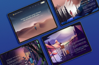
Some of my works in map design

Some of my works in map design

Some of my works in map design

Some of my works in map design

Some of my works in map design

Some of my works in map design

Some of my works in map design
Some of my works in map design
Some of my works in map design
Some of my works in map design
Some of my works in map design
Some of my works in map design
Some of my works in map design
Some of my works in map design
บันทึกการเปลี่ยนแปลง
ไม่มีบทวิจารณ์ที่นี่!
การศึกษา
National School of City Engineers
2022 - 2024
•
2 ปี
Algeria
2022 - 2024
•
2 ปี
Université de M'sila
2017 - 2022
•
5 ปี
Mster's degree in urban planning
Algeria
2017 - 2022
•
5 ปี
ส่งคำเชิญเรียบร้อยแล้ว
ขอบคุณ! เราได้ส่งลิงก์สำหรับเครดิตฟรีให้คุณทางอีเมลแล้ว
เกิดข้อผิดพลาดขณะส่งอีเมลของคุณ กรุณาลองอีกครั้ง
Freelancer
เกี่ยวกับ
ข้อกำหนด
หุ้นส่วน
แอป
ไม่สามารถคัดลอกไปยังคลิปบอร์ดได้ โปรดลองอีกครั้งหลังปรับเปลี่ยนการอนุญาต
คัดลอกไปยังคลิปบอร์ดแล้ว
กำลังโหลดตัวอย่าง
ได้รับอนุญาตสำหรับตำแหน่งทางภูมิศาสตร์
เซสชั่นการเข้าสู่ระบบของคุณหมดอายุและคุณได้ออกจากระบบแล้ว กรุณาเข้าสู่ระบบอีกครั้ง