


기타 인기 스킬


기타 인기 프로젝트
회사
Freelancer Enterprise로 경쟁 우위를 강화하세요.
분야 서비스
전 세계 어디서나 필요에 따라 대규모로 전문 지식을 제공합니다.
비즈니스 AI
최신 AI 기술 전문가가 비즈니스를 변화시키도록 하세요.
프리랜서 제품
Innovation Challenges
Turn challenges into breakthroughs with the largest innovation hub.
Freelancer API
Freelancer API를 사용하여 숙련된 프리랜서로 구성된 클라우드 인력에 액세스하세요.
현지 프로젝트
세계 어느 곳에서나 도움을 받으세요.
프리랜서 서비스
하는 방법

아이디어 찾기

자원

를 팔로우 했습니다.
팔로우 서비스의 지정 과정에서 문제가 발생하였습니다.
이 사용자의 경우에는 다른 사용자들의 팔로우 서비스를 허용하지 않고 있습니다.
이 사용자에 대한 팔로우 서비스를 이미 이용하고 계십니다.
고객님의 현재 멤버십 등급으로는 0 건까지만 팔로우가 가능합니다. 멤버십 서비스의 업그레이드는 여기에서 하시면 됩니다.
성공적으로 언팔로우했습니다
팔로우 서비스에 대한 지정 해제 과정에서 문제가 발생하였습니다.
님에 대한 고객님의 추천 절차가 모두 완료되었습니다.
사용자 추천 과정에서 문제가 발생하였습니다.
원인을 알 수 없는 문제가 발생하였습니다. 현재의 페이지에서 다시 읽기 버튼을 클릭하신 후에 재시도하여 주시기 바랍니다.
이메일에 대한 인증 절차가 완료되었습니다.
Mubeen S.
@smubeeen
5.0
84
6.5
6.5
99%
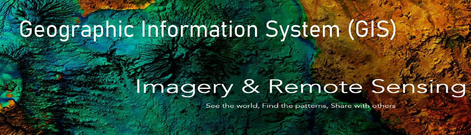
GIS, Remote Sensing & Mapping Enthusiast
$18 USD / 시간
・

Pakistan (11:43 PM)
・
11월 22, 2018에 가입
$18 USD / 시간
・
I Love to talk about maps. I am a Mapping Enthusiast with excellent command in open source as well as commercial GIS and Satellite Image Processing tools, I am versed in spatial analysis, Geodatabases, Web & digital mapping, and Remote Sensing analysis. I am also proficient in Web Development, I am a strong proponent of free and open-source tools. My academic experience has given me exposure towards developmental, urban and transport planning issues. I believe GIS as a mean of bridging different fields including but not limited to Urban Planning, Remote Sensing and Climate Sciences. Also a keen Data Science, Machine Learning, Deep Learning and Computer Vision enthusiast. I strive to maintain effective communication and collaboration throughout the project lifecycle.
Here are some of the services you can expect from me!
Remote sensing data acquisition, processing, and analysis
Spatial data analysis and Modeling.
Cartography and Map-making.
Automating GIS Workflow using Python.
Developing interactive web-based GIS maps and applications.
Providing GIS consulting and training services.
Google Earth Engine (GEE).
Dashboard Design using PowerBI.
Transportation planning & Route Optimization.
Geospatial database design and development (Post-GIS & PostgreSQL).
Spatial data infrastructures & Enterprise GIS systems (Geoserver / ArcGIS).
Developing custom GIS plugins and extensions.
Developing GIS web services and APIs for data sharing and integration.
Programming GIS Software Development with QGIS Development Libraries (GDAL/OGR, GEOS, Proj4, ArcPy and OSGeo4W third-party library PyQGIS ,PDAL).
FTTH Fiber Optics Planning, HLD, LLD, BOQ.
Spatial decision support systems.
Geostatistics and spatial statistics.
Geo-Marketing.
Arduino based GIS projects.
Development 3D Web apps.
인증
제시간에
96%
예산 금액 내에
98%
금액 수락
92%
재채용률
10%
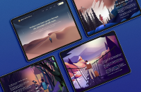
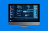
포트폴리오
포트폴리오

Development of an offline webmap to display intrusion

Volume Estimation of a Stockpile using Point Cloud Data

Volume Estimation of a Stockpile using Point Cloud Data

Volume Estimation of a Stockpile using Point Cloud Data

GIS-Based Dashboard

Fiber to the Home(FTTH) network planning

Fiber to the Home(FTTH) network planning

Elevation & Rainfall map of Panama for Botanical Exploration

Elevation & Rainfall map of Panama for Botanical Exploration

Using Service Area Analysis for Tourist Estimation

Using Service Area Analysis for Tourist Estimation

Using Service Area Analysis for Tourist Estimation
Development of an offline webmap to display intrusion
Volume Estimation of a Stockpile using Point Cloud Data
Volume Estimation of a Stockpile using Point Cloud Data
Volume Estimation of a Stockpile using Point Cloud Data
GIS-Based Dashboard
Fiber to the Home(FTTH) network planning
Fiber to the Home(FTTH) network planning
Elevation & Rainfall map of Panama for Botanical Exploration
Elevation & Rainfall map of Panama for Botanical Exploration
Using Service Area Analysis for Tourist Estimation
Using Service Area Analysis for Tourist Estimation
Using Service Area Analysis for Tourist Estimation
변경 내역 저장 완료
R
I hired Mubeen to map out construction data across three cities for a project, and they exceeded my expectations at every turn. They captured each location with impressive accuracy and organized the data into a flawless CSV file, making it incredibly easy to integrate into our workflow. Their attention to detail and dedication to quality were evident in every aspect of their work, from data precision to clear communication throughout the project. This level of professionalism is rare, and I highly recommend Mubeen for any mapping or data-related needs. Outstanding job!
Robert P.
@Rob25050
•

Lawndale, United States
•
공유
R
Very reliable, easy to work with, definitely recommend!
Roberta S.
@robertasevero99
•
Orlando, United States
•
공유
N
Was great to work with and very responsive!
Nicholas P.
@npatton23
•
Kalamazoo, United States
•
공유
R
Very responsive and helpful, super happy with my project!
Roberta S.
@robertasevero99
•
Orlando, United States
•
공유
E
Excellent work and responsive to changes needed.
Elaine M.
@emuir
•

Brisbane, Australia
•
공유
경험
GIS Specialist
2월, 2024 - 선물
•
11 , 3
The World Bank
2월, 2024 - 선물
•
11 , 3
Data Analysis
GIS based Solutions
Policy Planning
2월, 2024 - 선물
•
11 , 3
GIS Specialist
6월, 2022 - 2월, 2024
•
1 , 8
Ministry of Information Technology and Telecommunication, Pakistan
6월, 2022 - 2월, 2024
•
1 , 8
GIS Based Mapping
Automating GIS Workflow
Satellite Image Processing
Providing Solutions and Methodologies
Designing Maps
Telecom Infrastructure Planning
6월, 2022 - 2월, 2024
•
1 , 8
GIS and Remote Sensing Developer
12월, 2019 - 4월, 2022
•
2 , 3
Ministry of Climate Change, Pakistan
12월, 2019 - 4월, 2022
•
2 , 3
Managing Geodatabases
Utilize Python scripting to automate GIS workflows
Cartography
Matlab
Glaciers Monitoring
Maintaining, updating, and creating geospatial databases
12월, 2019 - 4월, 2022
•
2 , 3
교육
National University of Science and Technology
2022 - 2024
•
2
Remote Sensing & GIS
Pakistan
2022 - 2024
•
2
Pir Mehr Ali Shah Arid Agriculture University
2015 - 2019
•
4
Geo-Informatics
Pakistan
2015 - 2019
•
4
자격증
Contributor
2023
Openstreetmaps
Volunteer
2023
Environmental Activist Award
2019
Intergovernmental Panel on Climate Change
.
2019
ESRI certified Anaylst
2019
ESRI Organization
2019
자격증
P
Preferred Freelancer Program SLA

US English
초대장 발송이 완료되었습니다!
감사합니다! 무료 크레딧을 신청할 수 있는 링크를 이메일로 보내드렸습니다.
이메일을 보내는 동안 문제가 발생했습니다. 다시 시도해 주세요.
프리랜서
기업 소개
이용 약관
협력 단체
앱
클립보드로 복사하는 과정에서 문제가 발생하였습니다. 고객님의 권한 정보를 조정하신 후에 재시도하여 주시기 바랍니다.
클립보드로 복사되었습니다.
미리 보기 화면을 준비 중...
위치 정보 관련 접근권이 허용되었습니다.
고객님의 로그인 세션이 만료되어, 자동으로 로그아웃 처리가 되었습니다. 다시 로그인하여 주십시오.