

Seattle weather: Feeling more like fall this week
Seattle - The Puget Sound area will see cooler, early fall-like weather this week as a series of weather systems brings rain and cooler temperatures to Western Washington.
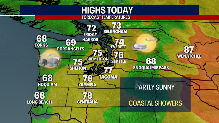
Monday will be the warmest day of the week, with highs in the 70s and partly sunny skies. The Washington Coast will see rain showers throughout the day, but they are not expected to make their way inland.
The Puget Sound area will stay partly cloudy and mainly dry Tuesday with showers returning to the coast. (FOX 13 Seattle)
Tuesday and Wednesday, those showers will push inland. Expect some light rain for the morning commute and a chance for some isolated thunderstorms in the afternoon.
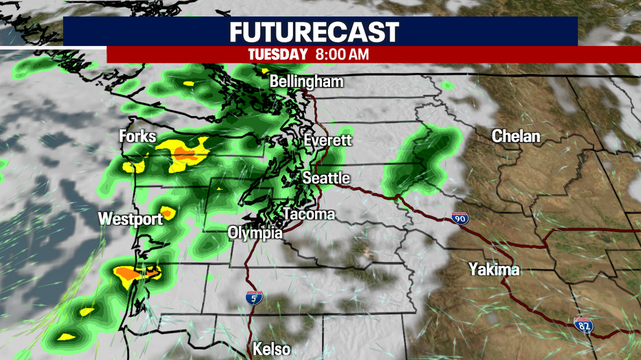
On and off rain showers are in the forecast for Western Washington Tuesday. (FOX 13 Seattle)
An upper level low will continue to impact the Pacific Northwest for the next several days. Thursday will bring another chance for thunderstorms and heavy downpours. Showers could linger into Friday and Saturday.
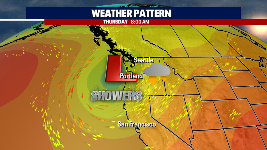
Another wet system will bring showers to the Pacific Northwest starting Tuesday. (FOX 13 Seattle)
Overall, it's going to be a cool week with highs about five to ten degrees below average.
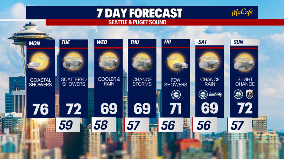
Seattle's 7 day forecast looks cool and wet at times. (FOX 13 Seattle)