

Seattle weather: Mostly cloudy and mountain storms Thursday
SEATTLE - Skies today have cleared, leading to plenty of sunshine and warmer temperatures.
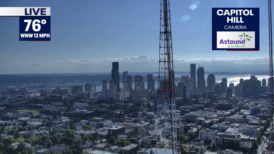
Skies today have cleared, leading to plenty of sunshine and warmer temperatures.
Highs today warmed back up to just below the seasonal average, in the upper 70s to low 80s.
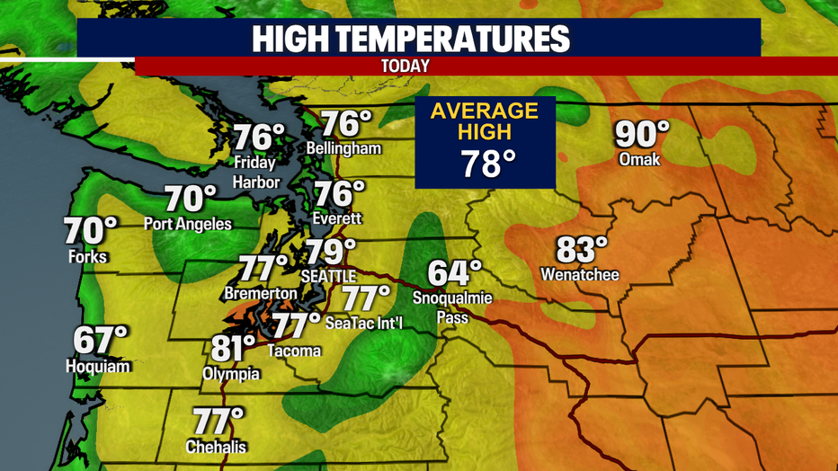
Highs today warmed back up to just below seasonal average, upper 70s to low 80s.
Skies will remain clear this evening, with mild overnight temperatures. Lows will be in the mid to upper 50s.
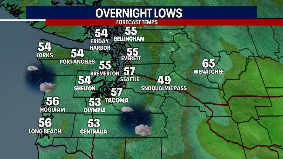
Skies will remain clear this evening, with mild overnight temperatures.
Skies will be cloudier Thursday, with a few sunbreaks into the afternoon and chance of mountain storms.

Skies will be cloudier Thursday, with a few sunbreaks into the afternoon and chance of mountain storms.
The Convective Outlook for Thursday will include a chance of storms for the Cascades. This will include dry lightning and gusty winds, increasing fire danger.
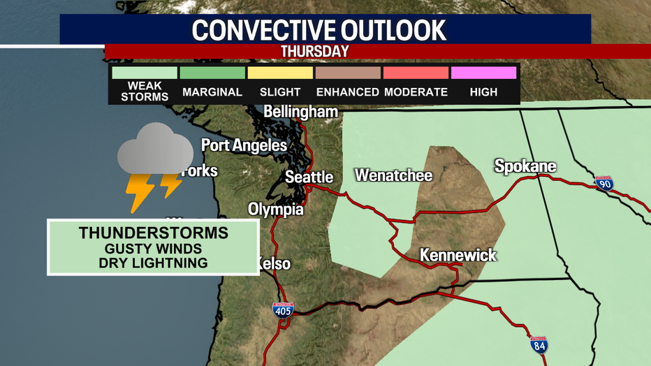
The Convective Outlook for Thursday will include a chance of storms for the Cascades.
An upper level low will be offshore this weekend, making its way across the Pacific Northwest, which will increase the chance of showers.

An upper level low will be offshore this weekend, making its way across the Pacific Northwest, which will increase the chance of showers.
Rain looks likely Saturday afternoon through early Sunday, with the possibility of thunderstorms.

Rain looks likely Saturday afternoon through early Sunday, with the possibility of thunderstorms. (FOX 13 Seattle)
Temperatures will remain below seasonal average through the weekend. A few more sunbreaks Friday afternoon after morning clouds to start the day. Sun and clouds return to begin the work week.
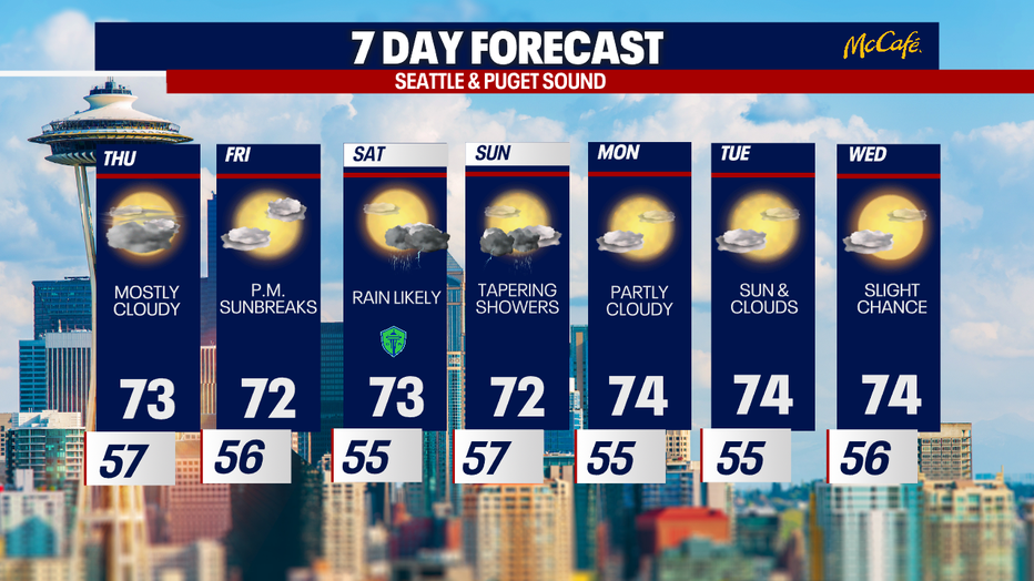
Temperatures will remain below seasonal average through the weekend.