

Seattle weather: Friday and Saturday could bring record cold
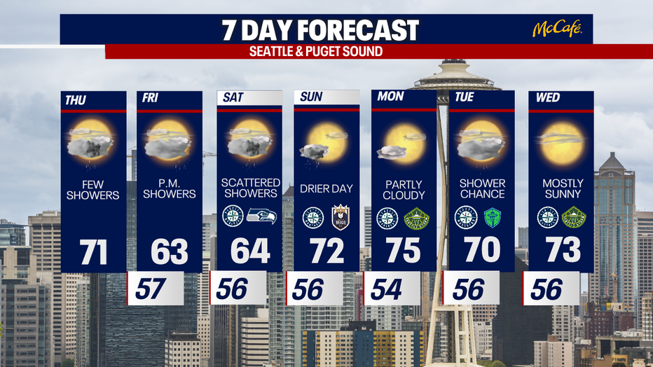
Seattle - Record cold high temperatures are possible Friday and Saturday as temps plummet into the low to mid 60s with a chance of showers.
Thursday will remain mild, but cooler than average. Expect mostly cloudy skies and temperatures back into the low 70s.
A low pressure system off the Washington and Oregon coasts will continue to spin isolated showers into the Puget Sound area, though the afternoon looks more dry than wet. Thunderstorms are possible west of the Cascades and in the mountains today.
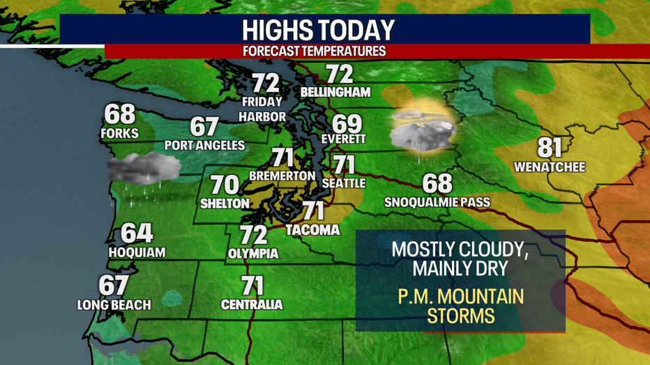
Temperatures will stay cooler than average Thursday with mostly cloudy skies and a few showers in Western Washington. (FOX 13 Seattle)
Friday, the low pressure system will move east, pushing a heavier round of moisture over the Puget Sound area and mountains. Rain chances increase as the day goes on, with heavier rain falling during the evening commute.
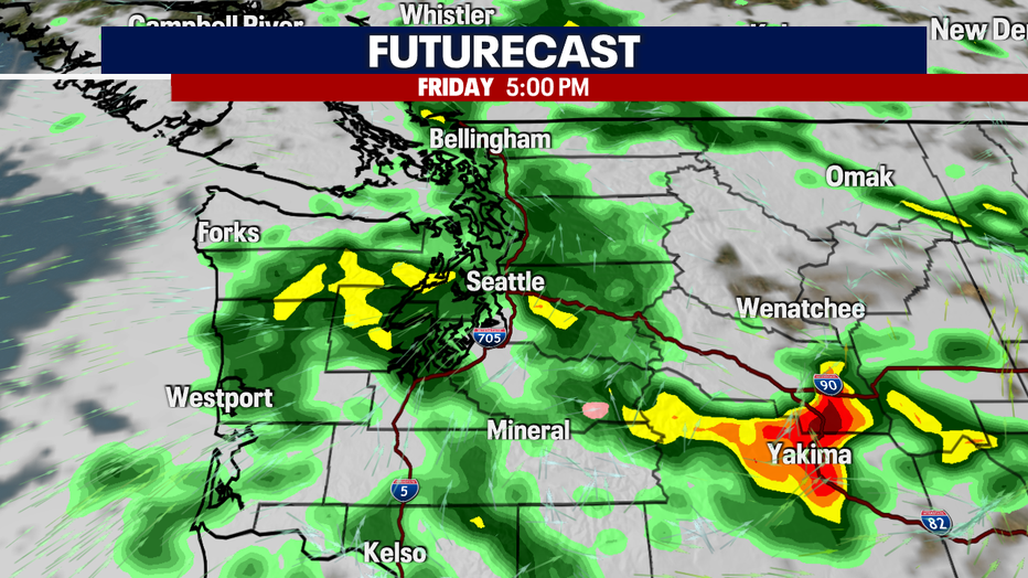
Heavier rain will pick up Friday afternoon in Western Washington. (FOX 13 Seattle)
Showers will continue through Saturday, with very cool afternoon temperatures. Sunday and Monday, we'll rebound with highs back into the 70s and partly cloudy skies.
Temperatures will cool dramatically Friday and Saturday in Seattle with showers and highs in the mid 60s. (FOX 13 Seattle)